Philippines
The Philippines is hit by a series of deadly disasters every year. See how we’ve responded to disasters over the years.
See More

We responded in the Philippines after Typhoon Goni caused destruction, landslides and extensive flooding.
The super typhoon was swiftly followed by Typhoon Vamco – the sixth named storm to hit the country in just three weeks.
It moved along a similar path to Goni and pushed response efforts back to zero as house repairs and temporary shelters were again destroyed.
We worked with our partners on the ground to support families displaced by Typhoon Goni. These devastating typhoons are a stark reminder that disasters don’t stop for coronavirus.
Read on for facts about Typhoon Goni and Vamco and see how we helped.
Typhoon Goni was the most powerful storm to hit the Philippines since Typhoon Haiyan in 2013, which killed around 6,000 people and affected millions more.
It made landfall in the Bicol region. Families from Albay and Catanduanes were in the epicentre of the storm and have been the worst affected. In Catanduanes at least 10,000 homes were damaged or destroyed.
Typhoon Vamco tracked slightly north of Goni, triggering severe flooding and landslides on Luzon island. Flooding again hit parts of Catanduanes and the Bicol region.
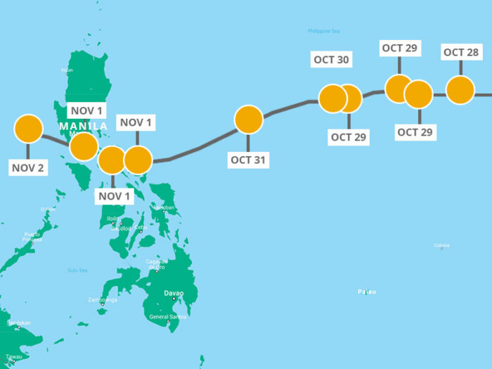
Take a look at this map of Typhoon Goni which details the path of the storm as it ripped through the country.
Typhoon Goni made landfall in the Philippines on November 1, killing at least 16 people.
The storm ripped through the Bicol and Calabarzon regions, south of the capital Manila. Families from Albay and Catanduanes were in the epicentre of the storm and have been the worst affected.
Typhoon Vamco, known locally as Ulysses, moved along a similar path to super Typhoon Goni.
The 6th named storm to hit the Philippines in just 3 weeks triggered severe flooding and landslides on Luzon island.
Although Vamco tracked slightly north of the path of Typhoon Goni, flooding again hit parts of Catanduanes and Bicol regions, forcing more evacuations.
Typhoon Goni was the most powerful storm recorded in 2020, bringing winds of 225km/h (140mph).
It’s reportedly the most powerful storm to hit the country since Typhoon Haiyan in 2013, which killed around 6,000 people and affected millions more.
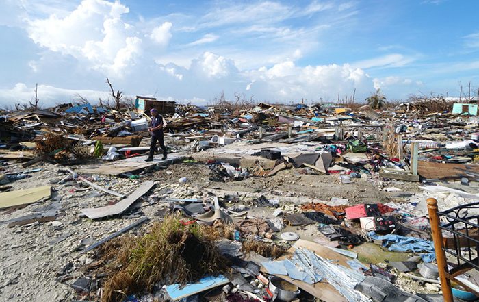
Typhoon Goni reportedly damaged 90% of the buildings in the first town it struck.
In Albay, lava deposits liquefied into mud flow, burying at least 300 homes.
In total, the storm affected around 2.1 million people. Reports showed that around 189,000 homes were damaged and there were around 23,000 people living in evacuation centres.
Typhoon Vamco affected around 3.6 million people. Reports showed that 67,000 homes were totally or partially destroyed and around 277,000 people had to flee to evacuation centres or stay with host families.
The provincial governor of Catanduanes said that response efforts from Typhoon Goni were back to zero as house repairs and temporary shelters were again destroyed by Vamco.
Typhoon Goni made landfall on Catanduanes island on Sunday November 1, ripping off roofs, taking down power and damaging homes and buildings.
Around 2.1 million people were affected by Typhoon Goni across northern areas of the Philippines, with nearly 1 million forced to evacuate their homes.
Typhoon Vamco brought yet more devastation, with around 3.6 million people affected and 277,000 people living in evacuation centres.
But coronavirus made the situation even more complicated.
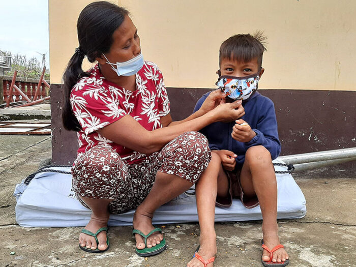
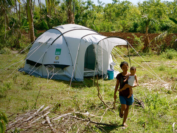
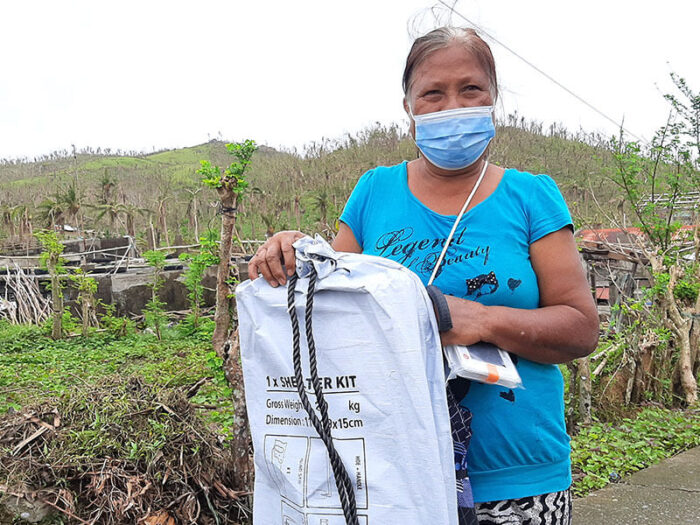
Our teams worked hard to support families affected by Typhoon Goni.
We worked with partners already on the ground, Humanity and Inclusion and Simon of Cyrene, to deliver emergency shelter.
Our supplies of shelter kits (including rope tarpaulins and nails), solar lights, water carriers, blankets and mosquito nets reached families in some of the worst affected areas.
Rotary in the Philippines connected us with local organisations, including the navy, and provided forklifts and trucking. Their support and network were invaluable yet again.

The Philippines is one of the world’s worst disaster-affected countries. We have responded to disasters in the Philippines more than any other country.
Warm ocean waters, low-lying coasts, poverty and geography help explain why the Philippines is so prone to disasters.
Located just above the equator, the Philippines faces the western Pacific without much else in the way to take the force of storms before they make landfall. Those warm, equatorial waters power about 20 typhoons a year.
In recent decades, significant numbers of people have been forced to live in risky, low-lying areas – havens for cheaper, temporary housing. The rapidly constructed housing and often inadequate evacuation plans mean that the local population is left vulnerable when disaster strikes. Existing houses are often unable to withstand extreme weather conditions.
On top of everything else, the country’s location on the Pacific Ring of Fire means it is prone to earthquakes, volcanic eruptions, tropical storms and typhoons.
Source: National Geographic